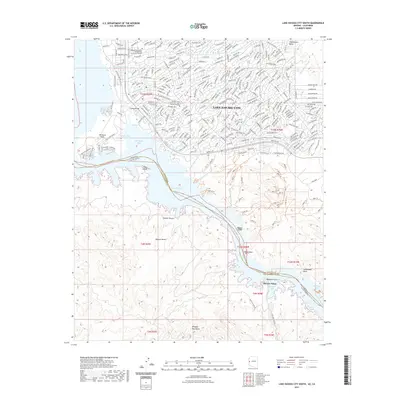
2021 Map of Lake Havasu City South
USGS Topo · Published 2021About this map
The London Bridge stands as a focal point in Lake Havasu City, linking the mainland to Pittsburg Point across a narrow channel. This survey documents the modern layout of the city and its educational institutions, including the Mohave Community College Lake Havasu City Campus and the Arizona State University-Lake Havasu Campus. The landscape is defined by the Colorado River's expansion into Lake Havasu, where the border between Arizona and California follows the deep-water channel. South of the city, the terrain transitions into the Mojave Desert and the high peaks of the Whipple Mountains. Numerous desert washes, such as Palo Verde Wash and Chemehuevi Wash, drain into the lake, illustrating the complex hydrology of the region. Distinctive landmarks like Pilot Rock and Steamboat Rock rise from the water's edge, while remote areas are accessed via tracks like Roulette Mine Rd and Trail End Camp Rd.
Find a feature on this map
53 named features on this map. Tap any name to fly to it.
Don’t see what you’re looking for? This feature index may not catch every label — zoom into the map to look around manually.
Map Details
Editions of this 2021 Lake Havasu City South Map
This is the sole edition of this map. No revisions or reprints were ever made.
Other maps of this area

1903 · Needles
USGS Topo · 1:125,000

1904 · Needles Special
USGS Topo · 1:125,000

1911 · Parker
USGS Topo · 1:125,000

1927 · Buck Mountains
USGS Topo · 1:62,500

1929 · Buck Mountains
USGS Topo · 1:62,500

1943 · Giers Basin
USGS Topo · 1:62,500

1943 · Topock
USGS Topo · 1:62,500

1943 · Whipple Mts.
USGS Topo · 1:62,500

1950 · Parker Dam Area
USGS Topo · 1:62,500

1950 · Topock
USGS Topo · 1:62,500