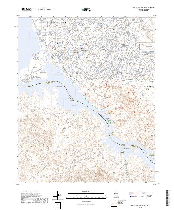
2023 Map of Lake Havasu City South
USGS Topo · Published 2023About this map
The Colorado River defines the border between Arizona and California on this survey of the southern reaches of Lake Havasu City. The landscape is a study in contrasting environments, where the dense suburban street grid of the city meets the protected desert of the Whipple Mountains Wilderness. Along the shoreline, specialized infrastructure such as Pittsburg Point and Thompson Bay serves the water-oriented community, while the presence of the Arizona State University - Lake Havasu Campus and Mohave Community College Lake Havasu City Campus indicates the area's development as an educational hub.
Find a feature on this map
56 named features on this map. Tap any name to fly to it.
Don’t see what you’re looking for? This feature index may not catch every label — zoom into the map to look around manually.
Map Details
Editions of this 2023 Lake Havasu City South Map
This is the sole edition of this map. No revisions or reprints were ever made.
Other maps of this area

1903 · Needles
USGS Topo · 1:125,000

1904 · Needles Special
USGS Topo · 1:125,000

1911 · Parker
USGS Topo · 1:125,000

1927 · Buck Mountains
USGS Topo · 1:62,500

1929 · Buck Mountains
USGS Topo · 1:62,500

1943 · Giers Basin
USGS Topo · 1:62,500

1943 · Topock
USGS Topo · 1:62,500

1943 · Whipple Mts.
USGS Topo · 1:62,500

1950 · Parker Dam Area
USGS Topo · 1:62,500

1950 · Topock
USGS Topo · 1:62,500