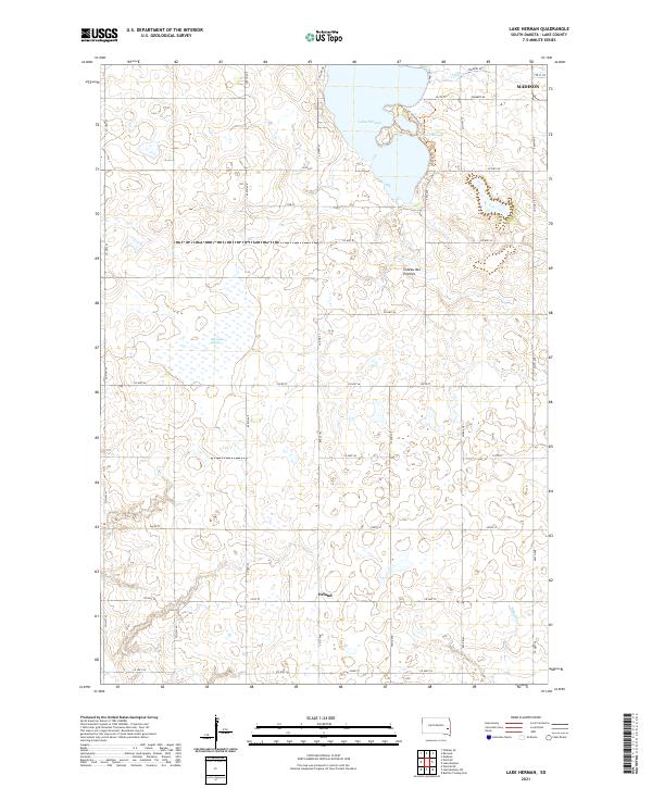
2021 Map of Lake Herman
USGS Topo · Published 2021About this map
Lake Herman and its surrounding wetlands define this portion of the Coteau des Prairies, a high glacial plateau in eastern South Dakota. The map captures a landscape where water and agriculture intersect, dominated by the significant bodies of Herman Slough and Reynolds Slough. These natural basins are characteristic of the region's post-glacial topography, providing a stark contrast to the rigid section-line grid of roads like Co Hwy 41 and 240th St that organize the prairie.
Find a feature on this map
45 named features on this map. Tap any name to fly to it.
Don’t see what you’re looking for? This feature index may not catch every label — zoom into the map to look around manually.
Map Details
Editions of this 2021 Lake Herman Map
This is the sole edition of this map. No revisions or reprints were ever made.
Other maps of this area

1953 · Watertown
USGS Topo · 1:250,000

1955 · Sioux Falls
USGS Topo · 1:250,000

1958 · Sioux Falls
USGS Topo · 1:250,000

1958 · Watertown
USGS Topo · 1:250,000

1968 · Lake Madison
USGS Topo · 1:24,000

1968 · Ramona
USGS Topo · 1:24,000

1968 · Madison
USGS Topo · 1:24,000
1968 · Buffalo Trading Post
USGS Topo · 1:24,000

1968 · Lake Madison SW
USGS Topo · 1:24,000

1968 · Lake Herman
USGS Topo · 1:24,000