
1968 Map of Madison
USGS Topo · Published 1970About this map
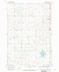
The city of Madison serves as a concentrated center of education and local government in this late-1960s survey of Lake County. The campus of General Beadle State College dominates the north-central part of the city, while a network of local schools including Central High Sch, Lincoln Sch, and St Thomas Sch are mapped in detail. The settlement pattern shows a dense urban grid giving way to the surrounding townships of Leroy and Lake View, with the southern edge defined by the Chicago Milwaukee St Paul and Pacific railroad tracks and industrial landmarks like the Madison Municipal Airport. Rural sections are marked by numerous Gravel Pits and small water bodies, while Battle Creek meanders through the eastern townships towards Wentworth. Notable civic spaces such as Memorial Park and Graceland Cem provide clear reference points for those tracing the mid-century layout of this South Dakota community.
Find a feature on this map
31 named features on this map. Tap any name to fly to it.
Don’t see what you’re looking for? This feature index may not catch every label — zoom into the map to look around manually.
Map Details
Editions of this 1968 Madison Map
This is the sole edition of this map. No revisions or reprints were ever made.
Other maps of this area

1953 · Watertown
USGS Topo · 1:250,000

1955 · Sioux Falls
USGS Topo · 1:250,000

1958 · Sioux Falls
USGS Topo · 1:250,000

1958 · Watertown
USGS Topo · 1:250,000

1968 · Lake Madison
USGS Topo · 1:24,000

1968 · Wentworth
USGS Topo · 1:24,000

1968 · Ramona
USGS Topo · 1:24,000

1968 · Sinai
USGS Topo · 1:24,000

1968 · Lake Herman
USGS Topo · 1:24,000
1968 · Madison NW
USGS Topo · 1:24,000