
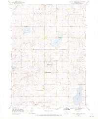
1968 Map of Lake Herman
USGS Topo · Published 1970About this map
Lake Herman and its glacial wetlands define this part of eastern South Dakota during the late 1960s. The landscape is characterized by a series of significant water bodies, including Herman Slough and the expansive Reynolds Slough, which dominate the central prairie. Development is concentrated around the lake's eastern shore at Lake Herman State Park and Camp Lakodia, while the surrounding townships of Herman and Orland maintain a sparse, rural character.
Find a feature on this map
17 named features on this map. Tap any name to fly to it.
Don’t see what you’re looking for? This feature index may not catch every label — zoom into the map to look around manually.
Map Details
Editions of this 1968 Lake Herman Map
This is the sole edition of this map. No revisions or reprints were ever made.
Other maps of this area

1953 · Watertown
USGS Topo · 1:250,000

1955 · Sioux Falls
USGS Topo · 1:250,000

1958 · Sioux Falls
USGS Topo · 1:250,000

1958 · Watertown
USGS Topo · 1:250,000

1968 · Lake Madison
USGS Topo · 1:24,000

1968 · Ramona
USGS Topo · 1:24,000

1968 · Madison
USGS Topo · 1:24,000
1968 · Buffalo Trading Post
USGS Topo · 1:24,000

1968 · Lake Madison SW
USGS Topo · 1:24,000

1968 · Oldham SE
USGS Topo · 1:24,000