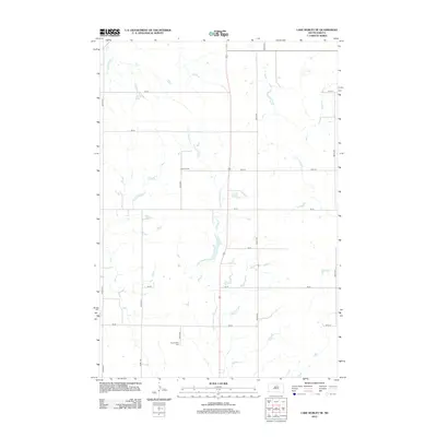
2012 Map of Lake Hurley NE
USGS Topo · Published 2012About this map
Little Cheyenne Cr meanders southward through this rural section of Potter County, defining the drainage of a landscape dominated by agricultural grid lines. This 2012 survey reveals a sparsely populated prairie region where the section lines are strictly maintained by a network of local roads such as 302nd Ave and 151st St. For genealogists and local historians, the map identifies two distinct burial sites that serve as primary markers of the area's pioneer heritage: Hanson Cem and Appomattox Cem. These small cemeteries are the primary cultural landmarks in an otherwise open terrain, illustrating the enduring presence of early family settlements and civil townships in central South Dakota.
Find a feature on this map
18 named features on this map. Tap any name to fly to it.
Don’t see what you’re looking for? This feature index may not catch every label — zoom into the map to look around manually.
Map Details
Editions of this 2012 Lake Hurley NE Map
This is the sole edition of this map. No revisions or reprints were ever made.
Other maps of this area

1953 · McIntosh
USGS Topo · 1:250,000

1954 · Aberdeen
USGS Topo · 1:250,000

1956 · Aberdeen
USGS Topo · 1:250,000

1958 · McIntosh
USGS Topo · 1:250,000

1968 · Akaska SW
USGS Topo · 1:24,000

1968 · Akaska
USGS Topo · 1:24,000

1970 · Steamboat Creek
USGS Topo · 1:24,000

1970 · Lake Hurley
USGS Topo · 1:24,000

1970 · Lake Hurley NE
USGS Topo · 1:24,000
1970 · Lake Hurley SE
USGS Topo · 1:24,000