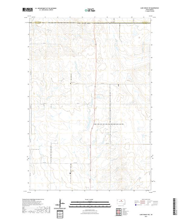
2021 Map of Lake Hurley NE
USGS Topo · Published 2021About this map
Little Cheyenne Creek meanders southward through the undulating high plains along the border of Walworth Co and Potter Co. The landscape is defined by the Public Land Survey System’s geometric precision, where section lines dictate a network of gravel roads such as 305th Ave and Co Rd 819. This rural expanse preserves small, quiet links to the area's pioneer past, most notably the Hanson Cem and Appomattox Cem, which stand as solitary landmarks amidst the vast agricultural sections. The drainage patterns of the Little Cheyenne Cr illustrate the natural topography that local ranchers and farmers have navigated for generations.
Find a feature on this map
21 named features on this map. Tap any name to fly to it.
Don’t see what you’re looking for? This feature index may not catch every label — zoom into the map to look around manually.
Map Details
Editions of this 2021 Lake Hurley NE Map
This is the sole edition of this map. No revisions or reprints were ever made.
Other maps of this area

1953 · McIntosh
USGS Topo · 1:250,000

1954 · Aberdeen
USGS Topo · 1:250,000

1956 · Aberdeen
USGS Topo · 1:250,000

1958 · McIntosh
USGS Topo · 1:250,000

1968 · Akaska SW
USGS Topo · 1:24,000

1968 · Akaska
USGS Topo · 1:24,000

1970 · Steamboat Creek
USGS Topo · 1:24,000

1970 · Lake Hurley
USGS Topo · 1:24,000

1970 · Lake Hurley NE
USGS Topo · 1:24,000
1970 · Lake Hurley SE
USGS Topo · 1:24,000