
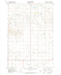
1970 Map of Lake Hurley NE
USGS Topo · Published 1972About this map
Little Cheyenne Creek meanders through this portion of Potter and Walworth Counties, shaping a landscape defined by expansive rural townships. In 1970, the area maintained its traditional agricultural character, evidenced by the presence of local landmarks like the Fayette Sch and the Hanson Cem, which serve as focal points for the surrounding farmsteads. The map clearly delineates the administrative boundaries of Fayette, Lowell, Appomattox, and Lincoln townships, illustrating the late-century settlement patterns of the South Dakota prairie. Surveyed using aerial photography from 1969, the sheet documents the network of fence and field lines that structured land use in this region before modern industrial farming further consolidated the plains.
Find a feature on this map
8 named features on this map. Tap any name to fly to it.
Don’t see what you’re looking for? This feature index may not catch every label — zoom into the map to look around manually.
Map Details
Editions of this 1970 Lake Hurley NE Map
This is the sole edition of this map. No revisions or reprints were ever made.
Other maps of this area

1953 · McIntosh
USGS Topo · 1:250,000

1954 · Aberdeen
USGS Topo · 1:250,000

1956 · Aberdeen
USGS Topo · 1:250,000

1958 · McIntosh
USGS Topo · 1:250,000

1968 · Akaska SW
USGS Topo · 1:24,000

1968 · Akaska
USGS Topo · 1:24,000

1970 · Steamboat Creek
USGS Topo · 1:24,000

1970 · Lake Hurley
USGS Topo · 1:24,000
1970 · Lake Hurley SE
USGS Topo · 1:24,000

1974 · Lowry
USGS Topo · 1:24,000