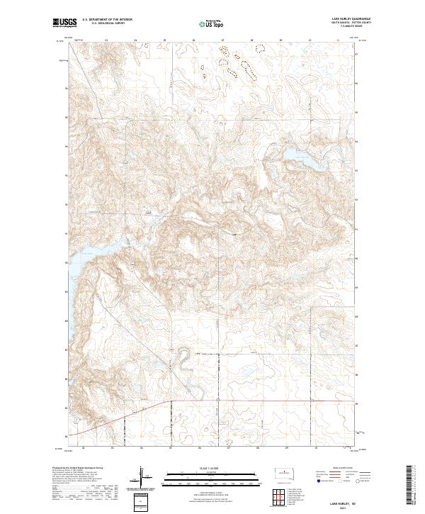
2021 Map of Lake Hurley
USGS Topo · Published 2021About this map
Lake Oahe defines the western margin of this Potter County landscape, where the Missouri River's impoundment meets the rolling prairie. The interior is characterized by the winding path of Little Cheyenne Creek, which drains toward the reservoir through a network of draws and depressions. Near the center of the sheet, the small, isolated Lake Hurley is a focal point of the local drainage system, situated just south of Hurly Pl. This 2021 survey reveals a modern section-line road network, including historic transport routes like Old 212 Rd and State Hwy 1804, which provide access to this ranching and agricultural region. The map illustrates the topographic transition from the high plains down to the water's edge, highlighting the persistence of rural infrastructure and water management in central South Dakota.
Find a feature on this map
23 named features on this map. Tap any name to fly to it.
Don’t see what you’re looking for? This feature index may not catch every label — zoom into the map to look around manually.
Map Details
Editions of this 2021 Lake Hurley Map
This is the sole edition of this map. No revisions or reprints were ever made.
Other maps of this area

1953 · McIntosh
USGS Topo · 1:250,000

1954 · Pierre
USGS Topo · 1:250,000

1958 · Pierre
USGS Topo · 1:250,000

1958 · McIntosh
USGS Topo · 1:250,000

1969 · Four Bear Creek
USGS Topo · 1:24,000

1969 · Patch Skin Buttes SE
USGS Topo · 1:24,000

1970 · Steamboat Creek
USGS Topo · 1:24,000

1970 · Lake Hurley
USGS Topo · 1:24,000

1970 · Lake Hurley NE
USGS Topo · 1:24,000

1970 · Agar NW
USGS Topo · 1:24,000