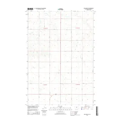
2015 Map of Lake Hurley SE
USGS Topo · Published 2015About this map
The rolling grasslands of eastern t119n r77w and t119n r76w define this rural landscape in Potter County. The primary watercourse, Little Cheyenne Cr, meanders through the northwest corner of the map, carving subtle drainage patterns into the high plains. This 2015 survey shows a highly structured section-line road network typical of the Great Plains, where gravel and local roads like 304th Ave and 161st St provide access to the vast agricultural plots. A major intersection occurs at the junction of Highway 83 and Highway 212 in the southern portion of the quadrangle, serving as a critical transit point for regional travel between these sprawling prairie townships.
Find a feature on this map
21 named features on this map. Tap any name to fly to it.
Don’t see what you’re looking for? This feature index may not catch every label — zoom into the map to look around manually.
Map Details
Editions of this 2015 Lake Hurley SE Map
This is the sole edition of this map. No revisions or reprints were ever made.
Other maps of this area

1953 · Huron
USGS Topo · 1:250,000

1953 · McIntosh
USGS Topo · 1:250,000

1954 · Aberdeen
USGS Topo · 1:250,000

1954 · Pierre
USGS Topo · 1:250,000

1954 · Huron
USGS Topo · 1:250,000

1956 · Aberdeen
USGS Topo · 1:250,000

1958 · Pierre
USGS Topo · 1:250,000

1958 · McIntosh
USGS Topo · 1:250,000

1970 · Steamboat Creek
USGS Topo · 1:24,000

1970 · Lake Hurley
USGS Topo · 1:24,000