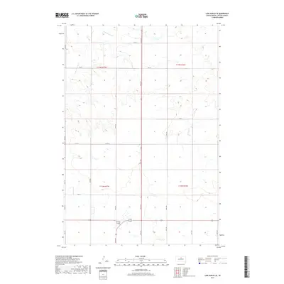
2017 Map of Lake Hurley SE
USGS Topo · Published 2017About this map
Little Cheyenne Cr meanders through the northwest corner of this Potter County landscape, illustrating the natural drainage patterns of the northern Missouri Plateau. This 2017 survey reflects the enduring grid of the Public Land Survey System, with the terrain organized into townships such as t119n r77w and t119n r76w. The area is defined by a sparse but essential road network, where long stretches of 305th Ave and Co Rd 104 connect isolated sections of farmland and prairie. The map provides a precise view of the rural infrastructure of the early 21st century, including the numerous small wetlands and topographic depressions typical of this glaciated region. Genealogists and local historians can trace property boundaries and land use along routes like 302nd Ave and 161st St, which mark the intersections of modern life with historic agricultural divisions.
Find a feature on this map
20 named features on this map. Tap any name to fly to it.
Don’t see what you’re looking for? This feature index may not catch every label — zoom into the map to look around manually.
Map Details
Editions of this 2017 Lake Hurley SE Map
This is the sole edition of this map. No revisions or reprints were ever made.
Other maps of this area

1953 · Huron
USGS Topo · 1:250,000

1953 · McIntosh
USGS Topo · 1:250,000

1954 · Aberdeen
USGS Topo · 1:250,000

1954 · Pierre
USGS Topo · 1:250,000

1954 · Huron
USGS Topo · 1:250,000

1956 · Aberdeen
USGS Topo · 1:250,000

1958 · Pierre
USGS Topo · 1:250,000

1958 · McIntosh
USGS Topo · 1:250,000

1970 · Steamboat Creek
USGS Topo · 1:24,000

1970 · Lake Hurley
USGS Topo · 1:24,000