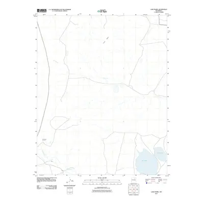
2010 Map of Lake Isabel
USGS Topo · Published 2010About this map
Old Sapello Cemetery and the small settlements of Baker and Craig anchor the southwestern portion of this San Miguel County landscape. The terrain is defined by the elevation of Riner Mesa to the north and the drainage systems of the Sapello River and Arroyo Jara that cut through the high plains. Water resources are central to the geography here, most notably with Lake Isabel and Lake David located in the southeastern quadrant. These water bodies and the surrounding drainage patterns reveal a rural New Mexico environment where ranching and local cemeteries mark the enduring human footprint on the land. The proximity of the settlements to the river suggest a historic reliance on these seasonal waterways for life and industry in this high-desert region during the first decade of the 21st century.
Find a feature on this map
8 named features on this map. Tap any name to fly to it.
Don’t see what you’re looking for? This feature index may not catch every label — zoom into the map to look around manually.
Map Details
Editions of this 2010 Lake Isabel Map
This is the sole edition of this map. No revisions or reprints were ever made.
Other maps of this area

1889 · Las Vegas
USGS Topo · 1:125,000

1891 · Las Vegas
USGS Topo · 1:125,000

1893 · Las Vegas
USGS Topo · 1:125,000

1954 · Santa Fe
USGS Topo · 1:250,000

1958 · Santa Fe
USGS Topo · 1:250,000

1961 · Montezuma
USGS Topo · 1:24,000

1963 · Lake Isabel
USGS Topo · 1:24,000

1963 · Fort Union
USGS Topo · 1:24,000

1963 · Rainsville
USGS Topo · 1:24,000
1963 · Las Vegas NW
USGS Topo · 1:24,000