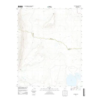
2013 Map of Lake Isabel
USGS Topo · Published 2013About this map
Arroyo Jara snakes across the high desert terrain of the San Miguel and Mora county line, defining the geographic character of this Northern New Mexico landscape. The northern portion is dominated by the broad elevation of Riner Mesa, while the southern reaches of the quadrangle focus on the water systems of the Sapello River. Near the river's path, the small settlements of Baker and Craig sit within reach of Lake Isabel and the adjacent Lake David. For those researching local lineages or the early transit routes of the area, the Old Sapello Cem remains a significant landmark near the corridor of NM-518, which provides the primary north-south passage through these high-altitude basins and mesas.
Find a feature on this map
10 named features on this map. Tap any name to fly to it.
Don’t see what you’re looking for? This feature index may not catch every label — zoom into the map to look around manually.
Map Details
Editions of this 2013 Lake Isabel Map
This is the sole edition of this map. No revisions or reprints were ever made.
Other maps of this area

1889 · Las Vegas
USGS Topo · 1:125,000

1891 · Las Vegas
USGS Topo · 1:125,000

1893 · Las Vegas
USGS Topo · 1:125,000

1954 · Santa Fe
USGS Topo · 1:250,000

1958 · Santa Fe
USGS Topo · 1:250,000

1961 · Montezuma
USGS Topo · 1:24,000

1963 · Lake Isabel
USGS Topo · 1:24,000

1963 · Fort Union
USGS Topo · 1:24,000

1963 · Rainsville
USGS Topo · 1:24,000
1963 · Las Vegas NW
USGS Topo · 1:24,000