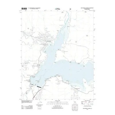
2012 Map of Lake Isabella North
USGS Topo · Published 2012About this map
Wofford Heights and the sprawling waters of Isabella Lake dominate this landscape at the southern end of the Sierra Nevada. The reservoir's complex shoreline is defined by numerous inlets like French Gulch, Paradise Cove, and Robinson Bay, supporting an extensive network of recreational sites such as Tillie Creek Campground and Camp Nine. The map reveals the local infrastructure serving the Kern River valley, including the Kern Valley Airport and the Kern River Valley Cem located just north of the lake. To the south, the settlement of Mountain Mesa sits near the Auxiliary Dam Campground. The terrain is marked by steep canyons and named peaks, including Cane Peak and Noyer Canyon, illustrating the dramatic elevation changes between the high ridges and the water level managed by the Main Dam Campground area.
Find a feature on this map
93 named features on this map. Tap any name to fly to it.
Don’t see what you’re looking for? This feature index may not catch every label — zoom into the map to look around manually.
Map Details
Editions of this 2012 Lake Isabella North Map
This is the sole edition of this map. No revisions or reprints were ever made.
Other maps of this area

1906 · Kernville
USGS Topo · 1:125,000

1908 · Kernville
USGS Topo · 1:125,000

1920 · Delonagha
USGS Topo · 1:62,500

1926 · Glennville
USGS Topo · 1:62,500

1936 · Tobias Peak
USGS Topo · 1:125,000

1943 · Tobias Peak
USGS Topo · 1:125,000

1943 · Isabella
USGS Topo · 1:62,500

1945 · Tobias Peak
USGS Topo · 1:62,500

1948 · Bakersfield
USGS Topo · 1:250,000

1955 · Bakersfield
USGS Topo · 1:250,000