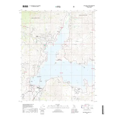
2018 Map of Lake Isabella North
USGS Topo · Published 2018About this map
Wofford Heights and the community of Lake Isabella anchor this survey of the southern Sierra Nevada foothills, where the Kern River feeds into the expansive Isabella Lake. The landscape is a complex of rugged terrain and water management, featuring numerous coves and points like Kissack Bay and Gautche Point. The presence of Edwards AFB and the Kern Valley Airport highlights the region's importance for aviation and defense. Cultural and historical landmarks are scattered throughout, from the Kern River Valley Cem to the local-history-rich Hot Spring Valley. Large portions of the area are managed as part of the Sequoia National Forest, while various canyons like Noyer Canyon and Yankee Canyon reveal the intricate drainage patterns that define this part of Kern County. The map also traces the winding routes of Highway 155 and Highway 178, which connect these lakeside settlements to the surrounding mountain passes.
Find a feature on this map
117 named features on this map. Tap any name to fly to it.
Don’t see what you’re looking for? This feature index may not catch every label — zoom into the map to look around manually.
Map Details
Editions of this 2018 Lake Isabella North Map
This is the sole edition of this map. No revisions or reprints were ever made.
Other maps of this area

1906 · Kernville
USGS Topo · 1:125,000

1908 · Kernville
USGS Topo · 1:125,000

1920 · Delonagha
USGS Topo · 1:62,500

1926 · Glennville
USGS Topo · 1:62,500

1936 · Tobias Peak
USGS Topo · 1:125,000

1943 · Tobias Peak
USGS Topo · 1:125,000

1943 · Isabella
USGS Topo · 1:62,500

1945 · Tobias Peak
USGS Topo · 1:62,500

1948 · Bakersfield
USGS Topo · 1:250,000

1955 · Bakersfield
USGS Topo · 1:250,000