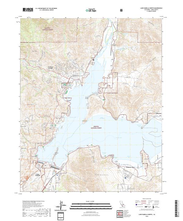
2022 Map of Lake Isabella North
USGS Topo · Published 2022About this map
Isabella Lake and its intricate shoreline dominate this geography, where the reservoir meets the steep southern edges of the Sequoia National Forest. The residential patterns of Wofford Heights and Mountain Mesa reveal the 21st-century development of this recreational and residential hub, with dozens of winding roads like Burlando Rd and Wofford Blvd providing access to the water's edge. The presence of the Kern Valley Airport and the Kern River Valley Cem indicates the area's role as a regional center for the Kern River valley.
Find a feature on this map
106 named features on this map. Tap any name to fly to it.
Don’t see what you’re looking for? This feature index may not catch every label — zoom into the map to look around manually.
Map Details
Editions of this 2022 Lake Isabella North Map
This is the sole edition of this map. No revisions or reprints were ever made.
Other maps of this area

1906 · Kernville
USGS Topo · 1:125,000

1908 · Kernville
USGS Topo · 1:125,000

1920 · Delonagha
USGS Topo · 1:62,500

1926 · Glennville
USGS Topo · 1:62,500

1936 · Tobias Peak
USGS Topo · 1:125,000

1943 · Tobias Peak
USGS Topo · 1:125,000

1943 · Isabella
USGS Topo · 1:62,500

1945 · Tobias Peak
USGS Topo · 1:62,500

1948 · Bakersfield
USGS Topo · 1:250,000

1955 · Bakersfield
USGS Topo · 1:250,000