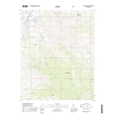
2018 Map of Lake Isabella South
USGS Topo · Published 2018About this map
Bodfish and the residential corridors of Squirrel Mountain Valley dominate the northern landscape, where the Kern River flows through Hot Spring Valley. This area serves as a significant interface between early settlement patterns and the high-elevation wilderness of the Sequoia National Forest. The map documents a complex network of local roads including Caliente Bodfish Rd and Bodfish Canyon Rd, which navigate the steep transition from the valley floor to the prominent summits of the Sierra Nevada range. Historical land use is evident in the naming of remote locales like Burton Mill and Studebaker Flat. Hydrological features such as Scovern Hot Springs and Gautche Springs suggest the importance of natural water sources in this arid environment, while peaks like Liebel Peak and Bodfish Peak define the physical boundaries of the southern Kern River drainage.
Find a feature on this map
73 named features on this map. Tap any name to fly to it.
Don’t see what you’re looking for? This feature index may not catch every label — zoom into the map to look around manually.
Map Details
Editions of this 2018 Lake Isabella South Map
This is the sole edition of this map. No revisions or reprints were ever made.
Other maps of this area

1906 · Kernville
USGS Topo · 1:125,000

1908 · Kernville
USGS Topo · 1:125,000

1914 · Caliente
USGS Topo · 1:125,000

1915 · Mojave
USGS Topo · 1:125,000

1920 · Delonagha
USGS Topo · 1:62,500

1926 · Glennville
USGS Topo · 1:62,500

1936 · Tobias Peak
USGS Topo · 1:125,000

1943 · Emerald Mtn
USGS Topo · 1:62,500

1943 · Breckenridge Mountain
USGS Topo · 1:62,500

1943 · Tobias Peak
USGS Topo · 1:125,000