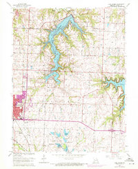
1963 Map of Lake Jacomo
USGS Topo · Published 1970About this map
Lake Jacomo dominates the landscape of eastern Jackson County, Missouri, its winding shoreline and numerous fingers such as Big Rock Bay and Buffalo Cove reflecting the 1960s expansion of regional recreation and water management. To the west, the growing town of Lees Summit is visible alongside the Chicago Rock Island and Pacific railroad, illustrating the suburban transition of the era. The southern portion of the sheet is defined by the James A Reed Memorial Wildlife Area, a cluster of small lakes including Lake Nell, Cottontail Lake, and Jackrabbit Lake. This network of managed reservoirs and conservation lands highlights a shift from traditional agricultural use toward recreational preservation. Historical local nodes are preserved through labels for the Mason School, Woods Chapel, and St Matthew Church, providing valuable points of reference for genealogists tracing family roots near Langsford and along the Little Blue River.
Find a feature on this map
35 named features on this map. Tap any name to fly to it.
Don’t see what you’re looking for? This feature index may not catch every label — zoom into the map to look around manually.
Map Details
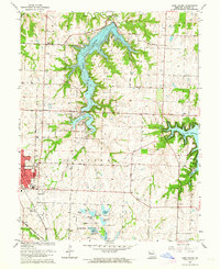
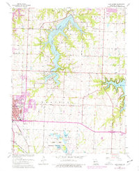
Editions of this 1963 Lake Jacomo Map
3 editions found
Other maps of this area

1887 · Harrisonville
USGS Topo · 1:125,000

1892 · Harrisonville
USGS Topo · 1:125,000

1894 · Harrisonville
USGS Topo · 1:125,000

1894 · Independence
USGS Topo · 1:125,000

1933 · Blue Springs
USGS Topo · 1:24,000

1934 · Oak Grove
USGS Topo · 1:24,000

1934 · Independence
USGS Topo · 1:24,000

1934 · Lees Summit
USGS Topo · 1:24,000

1934 · Woods Chapel
USGS Topo · 1:24,000

1935 · Tarsney
USGS Topo · 1:24,000