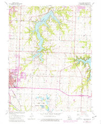
1963 Map of Lake Jacomo
USGS Topo · Published 1976About this map
Lake Jacomo dominates this portion of Jackson County, its branching fingers reaching into the surrounding terrain near the growing community of Lees Summit. This 1963 survey, with revisions through the mid-1970s, illustrates a landscape transitioning from rural crossroads to a regional recreation hub. The eastern edge is defined by Lake Lotawana, featuring distinct inlets like Big Rock Bay and Sunset Bay, while the James A Reed Memorial Wildlife Area provides a structured preserve to the south, dotted with smaller bodies of water such as Jackrabbit Lake and Lake Nell.
Find a feature on this map
50 named features on this map. Tap any name to fly to it.
Don’t see what you’re looking for? This feature index may not catch every label — zoom into the map to look around manually.
Map Details
Editions of this 1963 Lake Jacomo Map
3 editions found
Other maps of this area

1887 · Harrisonville
USGS Topo · 1:125,000

1892 · Harrisonville
USGS Topo · 1:125,000

1894 · Harrisonville
USGS Topo · 1:125,000

1894 · Independence
USGS Topo · 1:125,000

1933 · Blue Springs
USGS Topo · 1:24,000

1934 · Oak Grove
USGS Topo · 1:24,000

1934 · Independence
USGS Topo · 1:24,000

1934 · Lees Summit
USGS Topo · 1:24,000

1934 · Woods Chapel
USGS Topo · 1:24,000

1935 · Tarsney
USGS Topo · 1:24,000