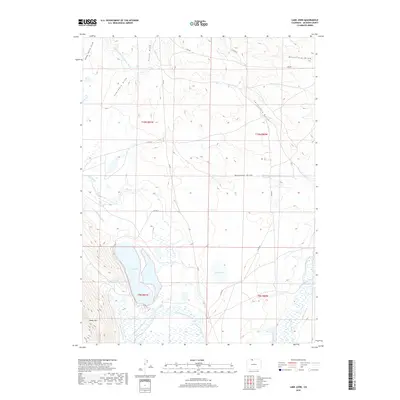
2019 Map of Lake John
USGS Topo · Published 2019About this map
Lake John and the surrounding high-altitude basin dominate this portion of Jackson County, where a sophisticated network of irrigation channels supports the local ranching economy. Significant water management features, such as the Bighorn Cattle Company Ditch, Legal Tender Ditch, and Hanson and Wattenberg Ditch, illustrate the historical effort to divert water from the North Platte River and its N Fork N Platte River across the dry terrain. To the southwest, the topography rises toward Sheep Mtn, while the landscape is carved by numerous drainages including California Gulch, Mansfield Draw, and Monahan Draw. This 2019 survey documents the enduring reliance on hydraulic engineering in the American West, featuring specific infrastructure like Brands Reservoir and the Ulrich Ditch that remain vital to the region's agricultural footprint.
Find a feature on this map
36 named features on this map. Tap any name to fly to it.
Don’t see what you’re looking for? This feature index may not catch every label — zoom into the map to look around manually.
Map Details
Editions of this 2019 Lake John Map
This is the sole edition of this map. No revisions or reprints were ever made.
Other maps of this area

1911 · Hahns Peak
USGS Topo · 1:125,000

1913 · Hahns Peak
USGS Topo · 1:125,000

1950 · Northgate
USGS Topo · 1:24,000

1952 · Northgate
USGS Topo · 1:24,000

1954 · Craig
USGS Topo · 1:250,000

1955 · Independence Mountain
USGS Topo · 1:24,000

1955 · Lake John
USGS Topo · 1:24,000

1955 · Pitchpine Mountain
USGS Topo · 1:24,000

1955 · Delaney Butte
USGS Topo · 1:24,000

1955 · Pearl
USGS Topo · 1:24,000