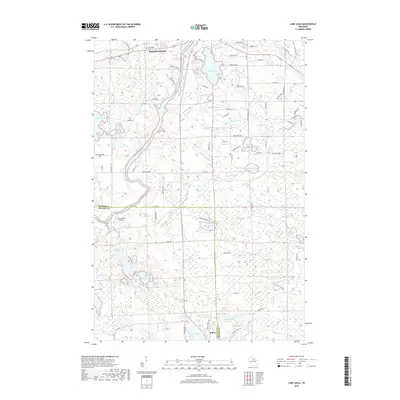
2018 Map of Lake Julia
USGS Topo · Published 2018About this map
The Rhinelander outskirts and the small settlement of Jeffris anchor this survey of Oneida and Lincoln counties, dominated by the winding path of the Wisconsin River. This glacial landscape is defined by an immense density of water bodies, from the prominent Lake Julia and Squaw Lake to smaller basins like Heal Lake and Loon Lake. The river's course is marked by the Hat Rapids and serves as a natural corridor for early transportation and industrial power, while the River Valley Airport sits just south of the main city center near the county line. The map reveals a transition from the urban-adjacent development of Rhinelander to the more dispersed lakeside homes and forest tracts toward the south, where Pine Lake and Hilderbrand Lake illustrate the area's enduring character as a destination for outdoor life and timber-related history.
Find a feature on this map
95 named features on this map. Tap any name to fly to it.
Don’t see what you’re looking for? This feature index may not catch every label — zoom into the map to look around manually.
Map Details
Editions of this 2018 Lake Julia Map
This is the sole edition of this map. No revisions or reprints were ever made.
Other maps of this area

1939 · Cassian
USGS Topo · 1:48,000

1940 · Parrish
USGS Topo · 1:48,000

1940 · Rhinelander
USGS Topo · 1:48,000

1942 · Cassian
USGS Topo · 1:48,000

1949 · Rhinelander
USGS Topo · 1:48,000

1950 · Parrish
USGS Topo · 1:48,000

1950 · Tomahawk
USGS Topo · 1:48,000

1952 · Parrish
USGS Topo · 1:48,000

1952 · Tomahawk
USGS Topo · 1:48,000

1954 · Iron Mountain
USGS Topo · 1:250,000