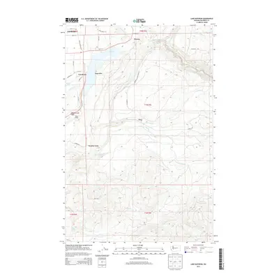
2013 Map of Lake Kapowsin
USGS Topo · Published 2013About this map
Lake Kapowsin sits at the heart of this Pierce County landscape, serving as a primary geographic anchor for the surrounding timber and mountain terrain. In the early 21st century, the small community of Kapowsin and the nearby Voss Resort represent the local settlement pattern at the lake's edge, while Electron to the north stands near the banks of the Puyallup River. The map reveals a complex drainage system defined by numerous creeks, including Tanwax Cr, Ohop Cr, and Twentyfive Mile Cr, which carve through the foothills east of Graham. The terrain is also marked by named valleys and localized points of interest like Ohop Valley, Surprise Valley, and the remote Wildcat Falls. This survey documents the intersection of rural residential pockets and the industrial-scale geography of the Pacific Northwest's river systems and forestry lands.
Find a feature on this map
44 named features on this map. Tap any name to fly to it.
Don’t see what you’re looking for? This feature index may not catch every label — zoom into the map to look around manually.
Map Details
Editions of this 2013 Lake Kapowsin Map
This is the sole edition of this map. No revisions or reprints were ever made.
Other maps of this area

1897 · Tacoma
USGS Topo · 1:125,000

1900 · Tacoma
USGS Topo · 1:125,000

1937 · Eatonville
USGS Topo · 1:125,000

1941 · Tanwax Lake
USGS Topo · 1:62,500

1941 · Tacoma South
USGS Topo · 1:62,500

1942 · Lake Tapps
USGS Topo · 1:62,500

1944 · Lake Tapps
USGS Topo · 1:62,500

1944 · Tacoma South
USGS Topo · 1:62,500

1944 · Ohop Valley
USGS Topo · 1:62,500

1949 · Ohop Valley
USGS Topo · 1:62,500