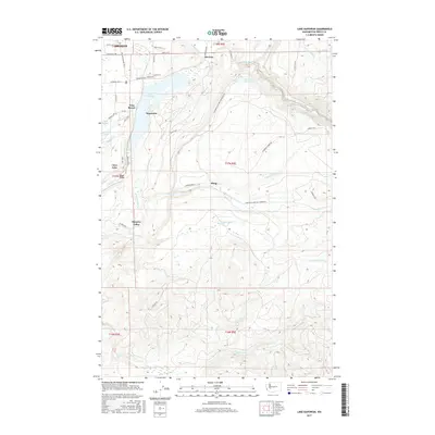
2017 Map of Lake Kapowsin
USGS Topo · Published 2017About this map
Lake Kapowsin dominates this portion of Pierce County, serving as a focal point for the surrounding settlements of Kapowsin and Voss Resort. The landscape is defined by its complex hydrology, where the Puyallup River flows near the Electron community and the Electron Reservoir. This area showcases a transition from the developing residential fringes of Graham in the northwest to the more isolated valley terrain of Ohop Valley and Surprise Valley further south.
Find a feature on this map
52 named features on this map. Tap any name to fly to it.
Don’t see what you’re looking for? This feature index may not catch every label — zoom into the map to look around manually.
Map Details
Editions of this 2017 Lake Kapowsin Map
This is the sole edition of this map. No revisions or reprints were ever made.
Other maps of this area

1897 · Tacoma
USGS Topo · 1:125,000

1900 · Tacoma
USGS Topo · 1:125,000

1937 · Eatonville
USGS Topo · 1:125,000

1941 · Tanwax Lake
USGS Topo · 1:62,500

1941 · Tacoma South
USGS Topo · 1:62,500

1942 · Lake Tapps
USGS Topo · 1:62,500

1944 · Lake Tapps
USGS Topo · 1:62,500

1944 · Tacoma South
USGS Topo · 1:62,500

1944 · Ohop Valley
USGS Topo · 1:62,500

1949 · Ohop Valley
USGS Topo · 1:62,500