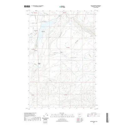
2020 Map of Lake Kapowsin
USGS Topo · Published 2020About this map
Lake Kapowsin dominates this portion of Pierce County, serving as a focal point for local settlement and early 20th-century industry. The hydroelectric legacy of the region is clearly visible through the Electron Flume and Electron Reservoir, which feed into the settlement of Electron on the Puyallup River. The landscape transitions from the water-rich lowlands near Voss Resort and Kapowsin to the ascending timberlands where the Champion Lumber Rd winds through the hills. This 2020 map documents a complex drainage system including Ohop Cr and Twentyfive Mile Cr, alongside named locales like Surprise Valley and Royce. The southern reaches of the quadrangle feature more isolated terrain, marked by Wildcat Falls and the headwaters of Lynch Cr.
Find a feature on this map
53 named features on this map. Tap any name to fly to it.
Don’t see what you’re looking for? This feature index may not catch every label — zoom into the map to look around manually.
Map Details
Editions of this 2020 Lake Kapowsin Map
This is the sole edition of this map. No revisions or reprints were ever made.
Other maps of this area

1897 · Tacoma
USGS Topo · 1:125,000

1900 · Tacoma
USGS Topo · 1:125,000

1937 · Eatonville
USGS Topo · 1:125,000

1941 · Tanwax Lake
USGS Topo · 1:62,500

1941 · Tacoma South
USGS Topo · 1:62,500

1942 · Lake Tapps
USGS Topo · 1:62,500

1944 · Lake Tapps
USGS Topo · 1:62,500

1944 · Tacoma South
USGS Topo · 1:62,500

1944 · Ohop Valley
USGS Topo · 1:62,500

1949 · Ohop Valley
USGS Topo · 1:62,500