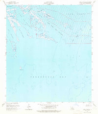
1956 Map of Lake La Graisse
USGS Topo · Published 1986About this map
Terrebonne Bay dominates the southern half of this coastal survey, where the Louisiana shoreline dissolves into an intricate network of marshes, lakes, and tidal passes. During the mid-1950s, this area was a primary site for resource extraction, evidenced by the presence of a Platform and an Oil Well situated amidst the shallow waters. The map details the complex hydrography of the region, including the large basins of Lake La Graisse and Lake Saint Jean Baptiste.
Find a feature on this map
17 named features on this map. Tap any name to fly to it.
Don’t see what you’re looking for? This feature index may not catch every label — zoom into the map to look around manually.
Map Details
Editions of this 1956 Lake La Graisse Map
3 editions found
Other maps of this area

1894 · Timbalier
USGS Topo · 1:62,500

1894 · Lake Felicity
USGS Topo · 1:62,500

1894 · Dulac
USGS Topo · 1:62,500

1935 · Cocodrie
USGS Topo · 1:31,680

1935 · Bourbeux
USGS Topo · 1:31,680

1935 · Timbalier Island
USGS Topo · 1:31,680

1935 · Lake Quitman
USGS Topo · 1:31,680

1939 · Lake Felicity
USGS Topo · 1:62,500

1941 · Lake Felicity
USGS Topo · 1:62,500

1941 · Dulac
USGS Topo · 1:62,500