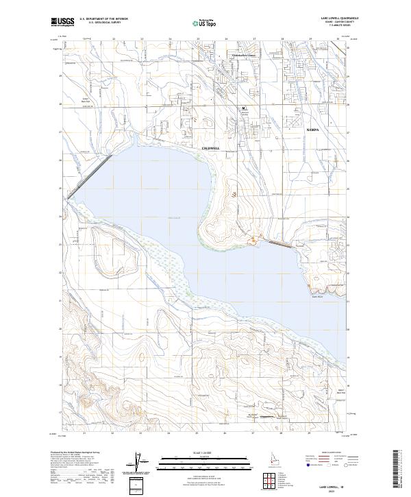
2023 Map of Lake Lowell
USGS Topo · Published 2023About this map
Lake Lowell dominates this Canyon County landscape, its broad waters contained by a complex network of engineering that reflects the region's agricultural heritage. The Deer Flat National Wildlife Refuge encompasses the reservoir and its immediate shoreline, providing a protected environment amidst the intensifying development of Caldwell and Nampa. The map reveals a highly structured irrigation system, where the Deer Flat Caldwell Canal, Phyllis Canal, and numerous laterals like the Burris Lateral and Messler Lateral distribute water across the Boise Valley floor.
Find a feature on this map
107 named features on this map. Tap any name to fly to it.
Don’t see what you’re looking for? This feature index may not catch every label — zoom into the map to look around manually.
Map Details
Editions of this 2023 Lake Lowell Map
This is the sole edition of this map. No revisions or reprints were ever made.
Other maps of this area

1892 · Silver City
USGS Topo · 1:125,000

1894 · Silver City
USGS Topo · 1:125,000

1898 · Nampa
USGS Topo · 1:125,000

1898 · Silver City
USGS Topo · 1:125,000

1955 · Boise
USGS Topo · 1:250,000

1957 · Opalene Gulch
USGS Topo · 1:24,000

1957 · Sands Basin
USGS Topo · 1:62,500

1957 · Notus
USGS Topo · 1:24,000

1958 · Boise
USGS Topo · 1:250,000
1958 · Givens Hot Springs
USGS Topo · 1:24,000