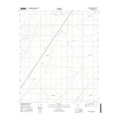
2017 Map of Lake Lucero SE
USGS Topo · Published 2017About this map
The White Sands Missile Range landscape of Otero County is defined by a sparse network of military routes and vital water catchments. These numbered roadways, such as Wsmr P RT 15 and Wsmr S RT 250, navigate a basin marked by small-scale hydraulic features essential for land management in this arid environment. Key water points like Burch Tank, Dousette Tank, and Tompson Reservoir provide the primary geographic landmarks across the desert floor. The grid-like organization of the terrain reflects the modern administrative control of this restricted area, where the vast open spaces are partitioned into townships such as t20s r6e and t21s r7e. This 2017 survey details the exact positioning of these range roads and reservoirs as they existed during a period of ongoing technological and tactical evolution within the Tularosa Basin.
Find a feature on this map
18 named features on this map. Tap any name to fly to it.
Don’t see what you’re looking for? This feature index may not catch every label — zoom into the map to look around manually.
Map Details
Editions of this 2017 Lake Lucero SE Map
This is the sole edition of this map. No revisions or reprints were ever made.
Other maps of this area

1916 · Point Of Sands
USGS Topo · 1:125,000

1940 · Orogrande
USGS Topo · 1:62,500

1943 · Parker Lake
USGS Topo · 1:62,500

1943 · Orogrande
USGS Topo · 1:62,500

1947 · Lake Lucero
USGS Topo · 1:62,500

1948 · Elephant Mountain
USGS Topo · 1:24,000
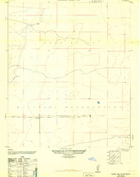
1948 · Parker Lake NE
USGS Topo · 1:24,000

1948 · Tres Hermanos
USGS Topo · 1:62,500

1948 · Lake Lucero
USGS Topo · 1:24,000

1948 · Lake Lucero SW
USGS Topo · 1:24,000