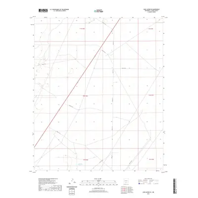
2020 Map of Lake Lucero SE
USGS Topo · Published 2020About this map
Tompson Reservoir provides a lone water source in the southern reaches of this arid landscape, situated within a strictly partitioned grid of the White Sands Missile Range. The terrain is defined by its military utility, where a network of specialized routes such as Wsmr P Rt 15 and Wsmr S Rt 254 crisscross the desert floor. These roads serve as the primary infrastructure through township sections like T20S R6E and T21S R6E, marking a landscape dedicated to government testing and defense operations rather than civilian settlement. This 2020 survey illustrates the modern configuration of these restricted access ways, offering a clear view of how the basin's topography has been adapted for contemporary range requirements.
Find a feature on this map
16 named features on this map. Tap any name to fly to it.
Don’t see what you’re looking for? This feature index may not catch every label — zoom into the map to look around manually.
Map Details
Editions of this 2020 Lake Lucero SE Map
This is the sole edition of this map. No revisions or reprints were ever made.
Other maps of this area

1916 · Point Of Sands
USGS Topo · 1:125,000

1940 · Orogrande
USGS Topo · 1:62,500

1943 · Parker Lake
USGS Topo · 1:62,500

1943 · Orogrande
USGS Topo · 1:62,500

1947 · Lake Lucero
USGS Topo · 1:62,500

1948 · Elephant Mountain
USGS Topo · 1:24,000
1948 · Parker Lake NE
USGS Topo · 1:24,000

1948 · Tres Hermanos
USGS Topo · 1:62,500

1948 · Lake Lucero
USGS Topo · 1:24,000

1948 · Lake Lucero SW
USGS Topo · 1:24,000