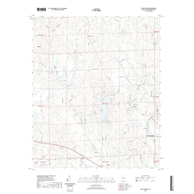
2020 Map of Lake Lurleen
USGS Topo · Published 2020About this map
Lake Lurleen and the surrounding woodlands of Tuscaloosa County define this modern landscape, where historical rural pockets persist alongside expanding suburban fringes. The area north of Northport is marked by numerous family and community burial grounds, such as Old Bethany Cem and the African-Methodist Episcopal Church Cem near Coker. These sites, along with names like Tabernacle Cem and Hendrix Cem, anchor the genealogy of the region.
Find a feature on this map
110 named features on this map. Tap any name to fly to it.
Don’t see what you’re looking for? This feature index may not catch every label — zoom into the map to look around manually.
Map Details
Editions of this 2020 Lake Lurleen Map
This is the sole edition of this map. No revisions or reprints were ever made.
Other maps of this area

1924 · Tuscaloosa
USGS Topo · 1:62,500

1926 · Samantha
USGS Topo · 1:48,000

1926 · Tuscaloosa
USGS Topo · 1:62,500

1928 · Samantha
USGS Topo · 1:62,500

1953 · Birmingham
USGS Topo · 1:250,000

1956 · Birmingham
USGS Topo · 1:250,000

1957 · Birmingham
USGS Topo · 1:250,000

1967 · Brownville
USGS Topo · 1:24,000

1967 · Elrod
USGS Topo · 1:24,000
1969 · Coker
USGS Topo · 1:24,000