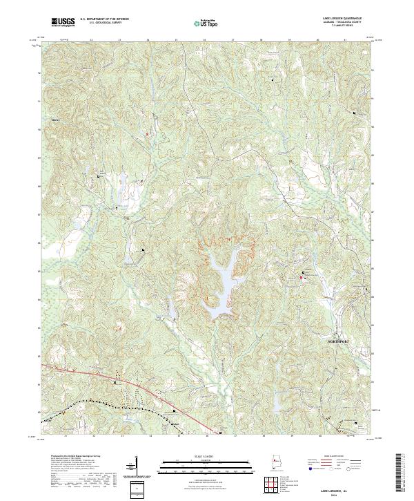
2024 Map of Lake Lurleen
USGS Topo · Published 2024About this map
Lake Lurleen and its surrounding drainages of Middle Creek and Big Creek dominate this modern topographical record of Tuscaloosa County. The landscape is defined by the winding paths of Wards Mill Creek and Hughes Mill Creek, feeding into impoundments like Lake Arnedra and Mills Lake Lower. Settlements such as Coker, Buhl, and Shirley are connected by a network of local roads including Co Rd 21 and Preacher Lee Rd, reflecting the modern rural development patterns of the region.
Find a feature on this map
108 named features on this map. Tap any name to fly to it.
Don’t see what you’re looking for? This feature index may not catch every label — zoom into the map to look around manually.
Map Details
Editions of this 2024 Lake Lurleen Map
This is the sole edition of this map. No revisions or reprints were ever made.
Other maps of this area

1924 · Tuscaloosa
USGS Topo · 1:62,500

1926 · Samantha
USGS Topo · 1:48,000

1926 · Tuscaloosa
USGS Topo · 1:62,500

1928 · Samantha
USGS Topo · 1:62,500

1953 · Birmingham
USGS Topo · 1:250,000

1956 · Birmingham
USGS Topo · 1:250,000

1957 · Birmingham
USGS Topo · 1:250,000

1967 · Brownville
USGS Topo · 1:24,000

1967 · Elrod
USGS Topo · 1:24,000
1969 · Coker
USGS Topo · 1:24,000