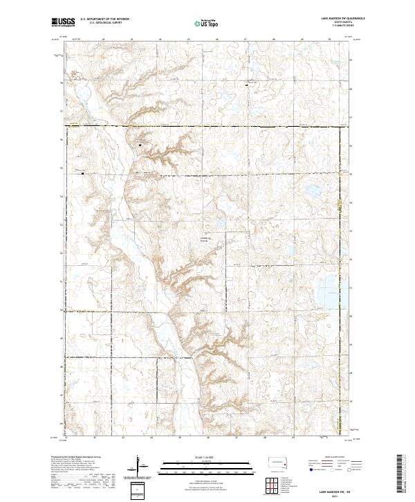
2021 Map of Lake Madison SW
USGS Topo · Published 2021About this map
Coteau des Prairies, a vast glacial plateau, dominates this portion of the South Dakota landscape where the Lake Co McCook Co line divides the terrain. The map documents a predominantly rural agricultural layout, defined by a grid of section lines and county highways like Co Hwy 58 and Co Hwy 35. For local historians and genealogists, the placement of several burial sites provides significant research value, including the Ramsey Pioneer Cem, the Ramsey Cem further south, and the Saint Peter Lutheran Cem near the northern boundary. Water features are concentrated in the eastern and western sections, notably the winding E Fork Vermillion River and the isolated Island Lake near the McCook Co Minnehaha Co border.
Find a feature on this map
34 named features on this map. Tap any name to fly to it.
Don’t see what you’re looking for? This feature index may not catch every label — zoom into the map to look around manually.
Map Details
Editions of this 2021 Lake Madison SW Map
This is the sole edition of this map. No revisions or reprints were ever made.
Other maps of this area

1955 · Sioux Falls
USGS Topo · 1:250,000

1958 · Sioux Falls
USGS Topo · 1:250,000

1964 · Montrose
USGS Topo · 1:24,000

1964 · Salem NE
USGS Topo · 1:24,000

1964 · Humboldt
USGS Topo · 1:24,000

1968 · Lake Madison
USGS Topo · 1:24,000
1968 · Buffalo Trading Post
USGS Topo · 1:24,000

1968 · Lake Madison SW
USGS Topo · 1:24,000

1968 · Lake Herman
USGS Topo · 1:24,000
1971 · Winfred
USGS Topo · 1:24,000
Featured Places
- Montrose Township, SD
- Richland Township, SD
- Brookfield Township, SD
- Clear Lake Township, SD
- Clarno Township, SD