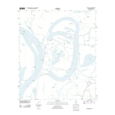
2012 Map of Lake Mary
USGS Topo · Published 2012About this map
Loch Leven and the expansive oxbow of Lake Mary dominate this riverine landscape in Wilkinson County, where the shifting path of the Mississippi River has created a complex network of islands and chutes. The territory is marked by small settlements and historic landings such as Artonish, Kienstra, and Pandella Landing, reflecting an era when river commerce was central to local life. Genealogists will find a wealth of family history preserved in numerous burial grounds, including Loch Leven Cem, Good Hope Cem, Singleton Cem, and Deer Park Cem. The land between the river and the bluffs is further defined by industrial activity at the Artonish Oil Field and the Old River Oil Field. Large landmasses like Steward Island and Johnson Island sit within the river's reaches, while smaller water bodies like Little Blue Hole and Horseshoe Lake punctuate the bottomlands near the Buffalo River.
Find a feature on this map
60 named features on this map. Tap any name to fly to it.
Don’t see what you’re looking for? This feature index may not catch every label — zoom into the map to look around manually.
Map Details
Editions of this 2012 Lake Mary Map
This is the sole edition of this map. No revisions or reprints were ever made.
Other maps of this area

1936 · Woodville
USGS Topo · 1:62,500

1939 · Kingston
USGS Topo · 1:62,500

1939 · Artonish
USGS Topo · 1:62,500

1939 · Deer Park
USGS Topo · 1:62,500

1953 · Natchez
USGS Topo · 1:250,000

1954 · Artonish
USGS Topo · 1:62,500

1955 · Artonish
USGS Topo · 1:62,500

1956 · Natchez
USGS Topo · 1:250,000

1958 · Artonish
USGS Topo · 1:62,500

1958 · Woodville
USGS Topo · 1:62,500