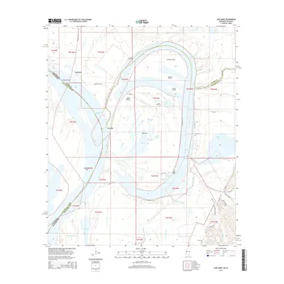
2015 Map of Lake Mary
USGS Topo · Published 2015About this map
The Mississippi River creates a complex landscape of shifting borders and landforms where Mississippi meets Louisiana. Significant topographic features like Steward Island, Johnson Island, and Big Island are defined by an intricate network of waterways including the Homochitto Cutoff, The Canal, and the large oxbow of Lake Mary. This river-driven geography is dotted with evidence of long-standing family and community life, such as Artonish and Loch Leven. Genealogists will find numerous small burial sites throughout the floodplain, including the Loch Leven Cem, McCoy Cem, and Good Hope Cem. The southern reach of the map shows the winding Buffalo River and Belmont Slough, while the hills to the east are crossed by rural tracks like Percy Creek Sand Rd and Old Millbrook Creek Rd.
Find a feature on this map
61 named features on this map. Tap any name to fly to it.
Don’t see what you’re looking for? This feature index may not catch every label — zoom into the map to look around manually.
Map Details
Editions of this 2015 Lake Mary Map
This is the sole edition of this map. No revisions or reprints were ever made.
Other maps of this area

1936 · Woodville
USGS Topo · 1:62,500

1939 · Kingston
USGS Topo · 1:62,500

1939 · Artonish
USGS Topo · 1:62,500

1939 · Deer Park
USGS Topo · 1:62,500

1953 · Natchez
USGS Topo · 1:250,000

1954 · Artonish
USGS Topo · 1:62,500

1955 · Artonish
USGS Topo · 1:62,500

1956 · Natchez
USGS Topo · 1:250,000

1958 · Artonish
USGS Topo · 1:62,500

1958 · Woodville
USGS Topo · 1:62,500