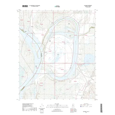
2018 Map of Lake Mary
USGS Topo · Published 2018About this map
The Mississippi River carves a complex alluvial landscape along the Louisiana and Mississippi border, creating a network of oxbow lakes, sloughs, and islands. At the heart of this terrain lies Lake Mary, a massive crescent water body south of Loch Leven. The geography here is defined by historical channel shifts, leaving behind features like the Old Homochitto River and the Homochitto Cut-off. These old river paths created isolated landmasses such as Steward Island, Johnson Island, and the large interior tract of Big Island, which is itself dotted with smaller bodies of water like Horseshoe Lake and Long Lake.
Find a feature on this map
55 named features on this map. Tap any name to fly to it.
Don’t see what you’re looking for? This feature index may not catch every label — zoom into the map to look around manually.
Map Details
Editions of this 2018 Lake Mary Map
This is the sole edition of this map. No revisions or reprints were ever made.
Other maps of this area

1936 · Woodville
USGS Topo · 1:62,500

1939 · Kingston
USGS Topo · 1:62,500

1939 · Artonish
USGS Topo · 1:62,500

1939 · Deer Park
USGS Topo · 1:62,500

1953 · Natchez
USGS Topo · 1:250,000

1954 · Artonish
USGS Topo · 1:62,500

1955 · Artonish
USGS Topo · 1:62,500

1956 · Natchez
USGS Topo · 1:250,000

1958 · Artonish
USGS Topo · 1:62,500

1958 · Woodville
USGS Topo · 1:62,500