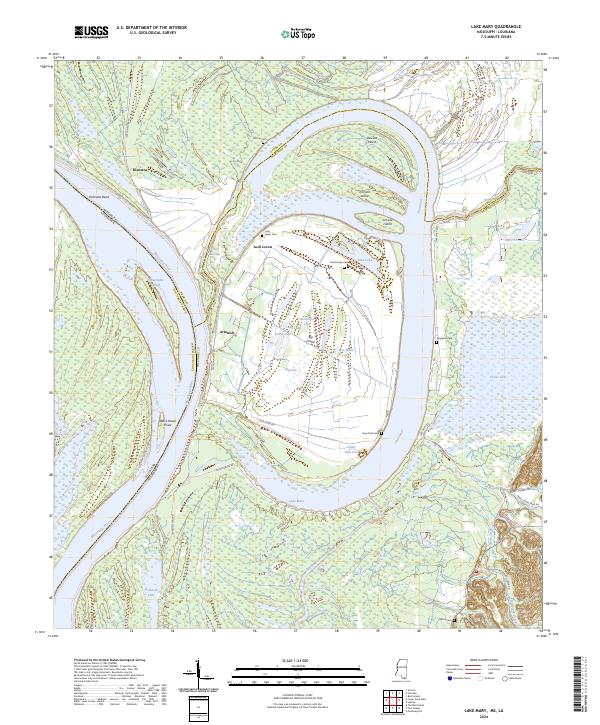
2024 Map of Lake Mary
USGS Topo · Published 2024About this map
The Narrows and the massive oxbow of Lake Mary dominate this landscape along the lower reaches of the Mississippi River, where the state line shifts between Mississippi Louisiana and Louisiana Mississippi. This intricate environment of fluvial islands and cutoffs, including Steward Island and Big Island, reveals a complex history of water management and land use. Small settlements like Loch Leven and Artonish are tied to the banks of these shifting water bodies, while a network of rural cemeteries, such as Good Hope Cem and Singleton Cem, provides essential points of reference for genealogists. The presence of The Canal and Little Canal north of the river suggests a heavily modified drainage system designed to navigate the wetlands and sloughs that define the border between Adams Co and Wilkinson Co.
Find a feature on this map
55 named features on this map. Tap any name to fly to it.
Don’t see what you’re looking for? This feature index may not catch every label — zoom into the map to look around manually.
Map Details
Editions of this 2024 Lake Mary Map
This is the sole edition of this map. No revisions or reprints were ever made.
Other maps of this area

1936 · Woodville
USGS Topo · 1:62,500

1939 · Kingston
USGS Topo · 1:62,500

1939 · Artonish
USGS Topo · 1:62,500

1939 · Deer Park
USGS Topo · 1:62,500

1953 · Natchez
USGS Topo · 1:250,000

1954 · Artonish
USGS Topo · 1:62,500

1955 · Artonish
USGS Topo · 1:62,500

1956 · Natchez
USGS Topo · 1:250,000

1958 · Artonish
USGS Topo · 1:62,500

1958 · Woodville
USGS Topo · 1:62,500