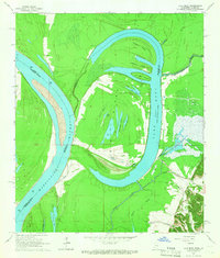
1965 Map of Lake Mary
USGS Topo · Published 1966About this map
The Lake Mary (Old River Lake) oxbow dominates this Mississippi River landscape, reflecting the shifting path of the river along the border of Louisiana and Mississippi. The area is defined by a complex network of interior waterways like Blue Lake, Long Lake, and Horseshoe Lake, which carve through the lowlands between Artonish and the Homochitto River. Small community centers and rural infrastructure are visible throughout the quadrangle, including the Hollywood Sch and several family or community burial grounds such as Loch Leven Cem and Good Hope Cem. The local economy of the mid-1960s is evidenced by the Lake Mary Oil Field and scattered Oil Wells, while the presence of The Canal and Little Canal suggests a history of water management in the flood-prone timber and marsh lands near the Buffalo River.
Find a feature on this map
47 named features on this map. Tap any name to fly to it.
Don’t see what you’re looking for? This feature index may not catch every label — zoom into the map to look around manually.
Map Details
Editions of this 1965 Lake Mary Map
This is the sole edition of this map. No revisions or reprints were ever made.
Other maps of this area

1936 · Woodville
USGS Topo · 1:62,500

1939 · Kingston
USGS Topo · 1:62,500

1939 · Artonish
USGS Topo · 1:62,500

1939 · Deer Park
USGS Topo · 1:62,500

1953 · Natchez
USGS Topo · 1:250,000

1954 · Artonish
USGS Topo · 1:62,500

1955 · Artonish
USGS Topo · 1:62,500

1956 · Natchez
USGS Topo · 1:250,000

1958 · Artonish
USGS Topo · 1:62,500

1958 · Woodville
USGS Topo · 1:62,500