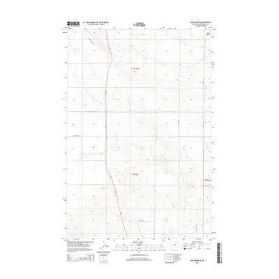
2014 Map of Lake Mason SE
USGS Topo · Published 2014About this map
The high plains of Musselshell County are defined here by the drainage of Willow Cr and its northern tributary, N Willow Cr. This landscape in the mid-2010s reveals a vast network of section-line roads and ranch access routes, including Snowy Mountain Rd and Alec Roy Rd, which serve the rural grazing lands of central Montana. The terrain is marked by the distinctive depression of Devils Basin in the northeast corner, a notable geological feature that contrasts with the surrounding township grids. Us-87 serves as the primary north-south artery, cutting through the heart of the territory. The presence of specialized local routes such as Grazing District Rd and Gage Dome Rd underscores the area's ongoing connection to agricultural and mineral interests, reflecting the long-standing land-use patterns of the region.
Find a feature on this map
14 named features on this map. Tap any name to fly to it.
Don’t see what you’re looking for? This feature index may not catch every label — zoom into the map to look around manually.
Map Details
Editions of this 2014 Lake Mason SE Map
This is the sole edition of this map. No revisions or reprints were ever made.
Other maps of this area

1954 · Roundup
USGS Topo · 1:250,000

1958 · Roundup
USGS Topo · 1:250,000

1979 · Roundup
USGS Topo · 1:100,000

1979 · Horsethief Creek
USGS Topo · 1:24,000

1979 · Gage
USGS Topo · 1:24,000

1979 · Roundup
USGS Topo · 1:24,000

1986 · Lake Mason SE
USGS Topo · 1:24,000

1986 · Lake Mason NE
USGS Topo · 1:24,000

1986 · Lake Mason NW
USGS Topo · 1:24,000

1986 · Big Wall West
USGS Topo · 1:24,000