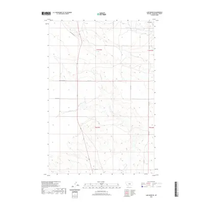
2020 Map of Lake Mason SE
USGS Topo · Published 2020About this map
Devils Basin dominates the northeastern corner of this Musselshell County landscape, where the terrain transitions into the drainage systems of N Willow Cr and Willow Cr. This modern survey illustrates a rural Montana environment defined by large-scale land management and a sparse network of service roads. The geography is structured by the Public Land Survey System, with township and range lines like t10n r25e and t9n r25e providing the primary framework for navigation and property boundaries. A handful of local thoroughfares, including Snowy Mountain Rd and Big Wall Rd, cut through the open country, connecting isolated points of interest. The area's character is underscored by names like Grazing District Rd, reflecting the region's enduring ties to ranching and livestock movement in the central Montana plains.
Find a feature on this map
14 named features on this map. Tap any name to fly to it.
Don’t see what you’re looking for? This feature index may not catch every label — zoom into the map to look around manually.
Map Details
Editions of this 2020 Lake Mason SE Map
This is the sole edition of this map. No revisions or reprints were ever made.
Other maps of this area

1954 · Roundup
USGS Topo · 1:250,000

1958 · Roundup
USGS Topo · 1:250,000

1979 · Roundup
USGS Topo · 1:100,000

1979 · Horsethief Creek
USGS Topo · 1:24,000

1979 · Gage
USGS Topo · 1:24,000

1979 · Roundup
USGS Topo · 1:24,000

1986 · Lake Mason SE
USGS Topo · 1:24,000

1986 · Lake Mason NE
USGS Topo · 1:24,000

1986 · Lake Mason NW
USGS Topo · 1:24,000

1986 · Big Wall West
USGS Topo · 1:24,000