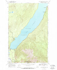
1968 Map of Lake Mc Donald West
USGS Topo · Published 1971About this map
Lake Mc Donald dominates this landscape, serving as the central axis for recreational and administrative development within Glacier National Park during the late 1960s. The settlement of Apgar at the lake's foot is shown as a hub of activity, featuring the Appar Campground, an Amphitheater, and proximity to the Park Headquarters & Reservoir. This era shows the infrastructure of seasonal tourism and park management firmly established, including the West Entrance Station and the Fish Creek Ranger Station.
Find a feature on this map
26 named features on this map. Tap any name to fly to it.
Don’t see what you’re looking for? This feature index may not catch every label — zoom into the map to look around manually.
Map Details
Editions of this 1968 Lake Mc Donald West Map
2 editions found
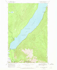
Other maps of this area

1904 · Chief Mountain
USGS Topo · 1:125,000

1906 · Kintla Lakes
USGS Topo · 1:125,000

1914 · Nyack
USGS Topo · 1:125,000

1938 · Chief Mountain
USGS Topo · 1:125,000

1938 · Kintla Lakes
USGS Topo · 1:125,000

1943 · Kalispell
USGS Topo · 1:125,000

1957 · Kalispell
USGS Topo · 1:250,000

1960 · Kalispell
USGS Topo · 1:250,000

1960 · Cut Bank
USGS Topo · 1:250,000

1961 · Kalispell
USGS Topo · 1:250,000