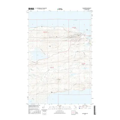
2017 Map of Lake Medora
USGS Topo · Published 2017About this map
Copper Harbor anchors the northern coastline of this Keweenaw Peninsula survey, where the rugged terrain of the Copper Country meets the cold waters of Lake Superior. The landscape is defined by dramatic ridgelines like Rocky Ridge, West Bluff, and Mt Houghton, with elevations dropping sharply toward the harbor and the southern marshes of Bete Grise. This geography dictated the local transport network, evidenced by the winding path of Brockway Mountain Dr and the logging and mining routes that branch into the interior.
Find a feature on this map
67 named features on this map. Tap any name to fly to it.
Don’t see what you’re looking for? This feature index may not catch every label — zoom into the map to look around manually.
Map Details
Editions of this 2017 Lake Medora Map
This is the sole edition of this map. No revisions or reprints were ever made.
Other maps of this area

1927 · Point Isabelle
USGS Topo · 1:31,680

1938 · Delaware
USGS Topo · 1:31,680

1939 · Deer Lake
USGS Topo · 1:31,680

1939 · Delaware
USGS Topo · 1:31,680

1940 · Deer Lake
USGS Topo · 1:31,680

1940 · Fort Wilkins
USGS Topo · 1:31,680

1940 · Lake Medora
USGS Topo · 1:31,680
1948 · Delaware
USGS Topo · 1:24,000
1948 · Lake Medora
USGS Topo · 1:24,000

1948 · Fort Wilkins
USGS Topo · 1:24,000