
1940 Map of Fort Wilkins
USGS Topo · Published 1940About this map
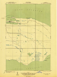
Fort Wilkins State Park sits at the northern tip of the Keweenaw Peninsula, anchoring this 1940 survey of Michigan's rugged shoreline. Compiled from 1938 aerial photography, the landscape shows a transition from the historic military post and Copper Harbor L H to the dense interior drainage of the Montreal River. The geography is defined by narrow lakes that run parallel to the Lake Superior coast, such as Lake Fanny Hooe and Lake Lily, which reflect the underlying geological ridges. Further south, the map reveals isolated water bodies like Hoar Lake and the winding course of Copper Creek, illustrating the wilderness character of the region before modern development. Notable coastal features like Keystone Pt and Horseshoe Harbor highlight the peninsula's jagged interface with the lake.
Find a feature on this map
26 named features on this map. Tap any name to fly to it.
Don’t see what you’re looking for? This feature index may not catch every label — zoom into the map to look around manually.
Map Details
Editions of this 1940 Fort Wilkins Map
2 editions found
Other maps of this area

1927 · Point Isabelle
USGS Topo · 1:31,680
1940 · Manitou Island
USGS Topo · 1:31,680

1940 · Lake Medora
USGS Topo · 1:31,680
1948 · Lake Medora
USGS Topo · 1:24,000

1948 · Fort Wilkins
USGS Topo · 1:24,000
1948 · Manitou Island
USGS Topo · 1:24,000
1948 · Point Isabelle
USGS Topo · 1:24,000
1949 · Manitou Island
USGS Topo · 1:24,000
1949 · Fort Wilkins
USGS Topo · 1:24,000
1949 · Lake Medora
USGS Topo · 1:24,000