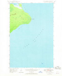
1948 Map of Point Isabelle
USGS Topo · Published 1968About this map
Mendota Light House stands as a vital maritime sentinel at the northern edge of this 1940s coastal survey. The map details the critical water connection between the open waters of Lake Superior and the sheltered Lac La Belle, linked via the Mendota Canal. This narrow passage represents a key piece of nautical engineering for the Keweenaw Peninsula, allowing vessels to bypass the exposed reaches of Bete Grise Bay. The landscape is dominated by the prominent protrusion of Point Isabelle, which separates the larger bay from the smaller Oliver Bay to the south. This survey, based on 1943 aerial photography, documents the shoreline and navigation aids as they appeared in the mid-20th century before significant modern development altered the remote character of this Lake Superior coastline.
Find a feature on this map
8 named features on this map. Tap any name to fly to it.
Don’t see what you’re looking for? This feature index may not catch every label — zoom into the map to look around manually.
Map Details
Editions of this 1948 Point Isabelle Map
2 editions found
Other maps of this area

1927 · Point Isabelle
USGS Topo · 1:31,680

1938 · Delaware
USGS Topo · 1:31,680

1939 · Deer Lake
USGS Topo · 1:31,680

1939 · Delaware
USGS Topo · 1:31,680

1940 · Deer Lake
USGS Topo · 1:31,680

1940 · Fort Wilkins
USGS Topo · 1:31,680

1940 · Lake Medora
USGS Topo · 1:31,680
1948 · Delaware
USGS Topo · 1:24,000
1948 · Lake Medora
USGS Topo · 1:24,000

1948 · Fort Wilkins
USGS Topo · 1:24,000