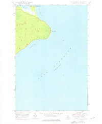
1948 Map of Point Isabelle
USGS Topo · Published 1976About this map
Point Isabelle projects into the cold waters of Lake Superior in this mid-century look at Michigan's Keweenaw Peninsula. The landscape is defined by its maritime isolation, dominated by the heavily forested terrain of Grant township. A critical navigational corridor is visible at the northern edge, where the Mendota Canal provides a vital link between the sheltered Lac La Belle and the expansive Bete Grise Bay. Standing as a sentinel for local mariners, the Mendota Light House marks the narrow passage that allowed vessels to seek refuge from the open lake. The topography is characterized by inland ridges and low-lying coastal marshes, particularly around the sweep of Oliver Bay to the south. This survey, updated with late 1970s photorevisions, illustrates the enduring and sparsely developed character of this Lake Superior shoreline.
Find a feature on this map
8 named features on this map. Tap any name to fly to it.
Don’t see what you’re looking for? This feature index may not catch every label — zoom into the map to look around manually.
Map Details
Editions of this 1948 Point Isabelle Map
2 editions found
Other maps of this area

1927 · Point Isabelle
USGS Topo · 1:31,680

1938 · Delaware
USGS Topo · 1:31,680

1939 · Deer Lake
USGS Topo · 1:31,680

1939 · Delaware
USGS Topo · 1:31,680

1940 · Deer Lake
USGS Topo · 1:31,680

1940 · Fort Wilkins
USGS Topo · 1:31,680

1940 · Lake Medora
USGS Topo · 1:31,680
1948 · Delaware
USGS Topo · 1:24,000
1948 · Lake Medora
USGS Topo · 1:24,000

1948 · Fort Wilkins
USGS Topo · 1:24,000