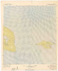
1949 Map of Manitou Island
USGS Topo · Published 1949About this map
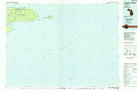
Manitou Island stands isolated in the waters of Lake Superior, serving as a critical navigational waypoint at the tip of the Keweenaw Peninsula. This 1949 survey documents the remote maritime infrastructure required for Great Lakes shipping, anchored by the Manitou Island L H and the solitary Gull Rock Lighthouse positioned between the island and the mainland at Keweenaw Point. The terrain of Grant township on the mainland is defined by a series of coastal indentations and inland waters, including Schlatter Lake and Gill Lake. A single Telephone Line provides a tenuous connection across this sparsely inhabited landscape, stretching toward the island's southern shore. The map illustrates a transitional period where traditional visual lighthouses were augmented by radio beacons, ensuring safe passage around these treacherous northern reaches.
Find a feature on this map
18 named features on this map. Tap any name to fly to it.
Don’t see what you’re looking for? This feature index may not catch every label — zoom into the map to look around manually.
Map Details
Editions of this 1949 Manitou Island Map
This is the sole edition of this map. No revisions or reprints were ever made.
Other maps of this area
1940 · Manitou Island
USGS Topo · 1:31,680

1940 · Fort Wilkins
USGS Topo · 1:31,680

1948 · Fort Wilkins
USGS Topo · 1:24,000
1948 · Manitou Island
USGS Topo · 1:24,000
1949 · Fort Wilkins
USGS Topo · 1:24,000

1958 · Hancock
USGS Topo · 1:250,000

1960 · Hancock
USGS Topo · 1:250,000

1961 · Hancock
USGS Topo · 1:250,000

1966 · Hancock
USGS Topo · 1:250,000
1985 · Copper Harbor
USGS Topo · 1:100,000