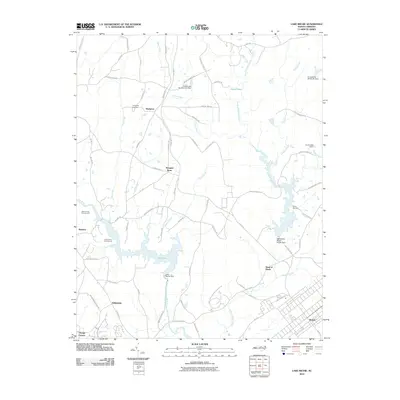
2010 Map of Lake Michie
USGS Topo · Published 2010About this map
Lake Michie serves as the central focal point of this Durham County landscape, formed by the Lake Michie Dam on the Flat River. The surrounding area is characterized by small rural crossroads and settlements such as Bahama, Hampton, and Willardville, reflecting a history of community hubs like Mangum Store and local industry at Orange Factory. The terrain is marked by a complex network of waterways, including Knap of Reeds Creek and Rocky Creek, which feed into the primary reservoir.
Find a feature on this map
75 named features on this map. Tap any name to fly to it.
Don’t see what you’re looking for? This feature index may not catch every label — zoom into the map to look around manually.
Map Details
Editions of this 2010 Lake Michie Map
This is the sole edition of this map. No revisions or reprints were ever made.
Other maps of this area

1943 · Roxboro
USGS Topo · 1:62,500

1943 · Creedmoor
USGS Topo · 1:62,500

1944 · Creedmoor
USGS Topo · 1:62,500

1951 · Durham North
USGS Topo · 1:62,500

1953 · Oxford
USGS Topo · 1:62,500

1953 · Greensboro
USGS Topo · 1:250,000

1954 · Greensboro
USGS Topo · 1:250,000

1962 · Greensboro
USGS Topo · 1:250,000

1966 · Greensboro
USGS Topo · 1:250,000

1966 · Oxford
USGS Topo · 1:62,500