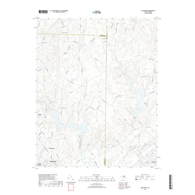
2019 Map of Lake Michie
USGS Topo · Published 2019About this map
Lake Michie serves as the focal point of this North Carolina landscape, where the Flat River winds through the borderlands of Durham, Granville, and Person counties. The 2019 survey documents the rural character of northern Durham County, centered on the community of Bahama and the crossroads at Willardville. Historical layers are evident in labels like Orange Factory, recalling the area's manufacturing roots along the riverbanks, and the secluded Carrington Cem. The topography is defined by prominent rises like Red Mountain, while water features such as Knap of Reeds Cr, Hester Lake, and Lake Butner illustrate the complex watershed management of the region. This modern topographic record captures the transition from historic farmsteads, represented by family names like Tilley Farm Rd and Potluck Farm Rd, to the residential expansion nearing the northern reaches of Durham and Butner.
Find a feature on this map
106 named features on this map. Tap any name to fly to it.
Don’t see what you’re looking for? This feature index may not catch every label — zoom into the map to look around manually.
Map Details
Editions of this 2019 Lake Michie Map
This is the sole edition of this map. No revisions or reprints were ever made.
Other maps of this area

1943 · Roxboro
USGS Topo · 1:62,500

1943 · Creedmoor
USGS Topo · 1:62,500

1944 · Creedmoor
USGS Topo · 1:62,500

1951 · Durham North
USGS Topo · 1:62,500

1953 · Oxford
USGS Topo · 1:62,500

1953 · Greensboro
USGS Topo · 1:250,000

1954 · Greensboro
USGS Topo · 1:250,000

1962 · Greensboro
USGS Topo · 1:250,000

1966 · Greensboro
USGS Topo · 1:250,000

1966 · Oxford
USGS Topo · 1:62,500