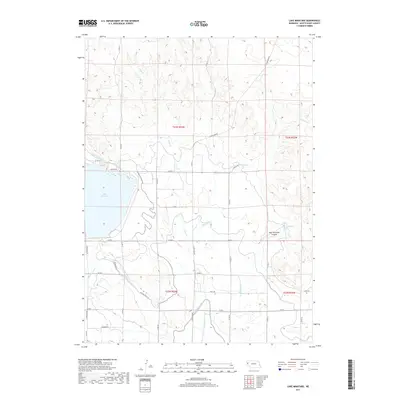
2017 Map of Lake Minatare
USGS Topo · Published 2017About this map
Lake Minatare dominates the western landscape of this Nebraska Panhandle survey, its shoreline traced by Lakeside Dr and fed by the complex irrigation network of the North Platte Valley. This 2017 edition illustrates the critical role of water management in Scotts Bluff County, detailing the paths of the Tri-State Canal, the High Line Canal, and the Lowline Canal. The terrain is defined by dramatic erosional features like East Ninemile Canyon and the winding course of Ninemile Cr as it moves toward the valley floor. Rural development is marked by a precise grid of county roads, including Stonegate Rd and N Highland Rd, which connect the scattered agricultural holdings and rangelands of the High Plains. Drainage features such as Alliance Drain and Hope Cr further underscore the intensive engineering required to sustain agriculture in this arid region.
Find a feature on this map
34 named features on this map. Tap any name to fly to it.
Don’t see what you’re looking for? This feature index may not catch every label — zoom into the map to look around manually.
Map Details
Editions of this 2017 Lake Minatare Map
This is the sole edition of this map. No revisions or reprints were ever made.
Other maps of this area

1898 · Scotts Bluff
USGS Topo · 1:125,000

1898 · Camp Clarke
USGS Topo · 1:125,000

1899 · Whistle Creek
USGS Topo · 1:125,000

1951 · Kilpatrick Lake
USGS Topo · 1:62,500

1954 · Scottsbluff
USGS Topo · 1:250,000

1955 · Alliance
USGS Topo · 1:250,000

1957 · Alliance
USGS Topo · 1:250,000

1958 · Alliance
USGS Topo · 1:250,000

1958 · Scottsbluff
USGS Topo · 1:250,000

1965 · Minatare
USGS Topo · 1:24,000