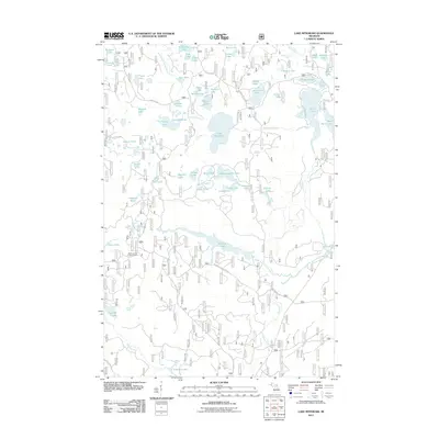
2011 Map of Lake Mitigwaki
USGS Topo · Published 2011About this map
The Mallard Lake Lookout Tower stands as a prominent point of navigation within this heavily forested portion of Iron County, overlooking a complex system of waterways and timber access roads. This 2011 survey details a landscape defined by its glacial hydrology, where the North Branch Paint River and the Tamarack River drain a series of interconnected basins. The presence of Lake Mitigwaki and Mallard Lake indicates the importance of these water bodies for local recreation and drainage. The map provides a precise record of the United States Forest Service infrastructure, including Federal Forest 2100 Rd and Federal Forest 3340 Rd, which cut through the dense network of named ponds and lakes such as Fisher Lake and Englesby Lake. This area remains largely dominated by forestry and natural conservation, with little permanent residential development shown.
Find a feature on this map
70 named features on this map. Tap any name to fly to it.
Don’t see what you’re looking for? This feature index may not catch every label — zoom into the map to look around manually.
Map Details
Editions of this 2011 Lake Mitigwaki Map
This is the sole edition of this map. No revisions or reprints were ever made.
Other maps of this area

1938 · Phelps
USGS Topo · 1:48,000

1950 · Phelps
USGS Topo · 1:48,000

1952 · Watersmeet
USGS Topo · 1:62,500

1954 · Kenton
USGS Topo · 1:62,500

1956 · Beechwood
USGS Topo · 1:62,500

1956 · Phelps
USGS Topo · 1:62,500

1958 · Iron River
USGS Topo · 1:250,000

1960 · Iron River
USGS Topo · 1:250,000

1961 · Iron River
USGS Topo · 1:250,000

1967 · Iron River
USGS Topo · 1:250,000
Featured Places
- Stambaugh Township, MI
- Interior Township, MI
- Watersmeet Township, MI
- Iron River Township, MI
- Gogebic County, MI