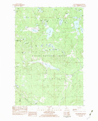
1982 Map of Lake Mitigwaki
USGS Topo · Published 1983About this map
Lake Mitigwaki serves as the centerpiece of this interior Upper Peninsula landscape, located within the expansive Ottawa National Forest. The map documents a heavily glaciated terrain defined by dozens of small named water bodies, including Tinsel Lake, Paw Lake, and Paint Lake, interspersed with the winding courses of the Jumbo River and its branches. Human intervention in this wilderness is marked by the presence of hydraulic infrastructure like Bear Trap Dam and Spaulding Dam, alongside the industrial footprint of the Chicago and North Western railroad corridor in the southwest corner. The transition of county lines between Ontonagon, Gogebic, and Iron counties highlights the administrative divisions of this remote timber and recreation country during the early 1980s.
Find a feature on this map
65 named features on this map. Tap any name to fly to it.
Don’t see what you’re looking for? This feature index may not catch every label — zoom into the map to look around manually.
Map Details
Editions of this 1982 Lake Mitigwaki Map
This is the sole edition of this map. No revisions or reprints were ever made.
Other maps of this area

1938 · Phelps
USGS Topo · 1:48,000

1950 · Phelps
USGS Topo · 1:48,000

1952 · Watersmeet
USGS Topo · 1:62,500

1954 · Kenton
USGS Topo · 1:62,500

1956 · Beechwood
USGS Topo · 1:62,500

1956 · Phelps
USGS Topo · 1:62,500

1958 · Iron River
USGS Topo · 1:250,000

1960 · Iron River
USGS Topo · 1:250,000

1961 · Iron River
USGS Topo · 1:250,000

1967 · Iron River
USGS Topo · 1:250,000
Featured Places
- Iron River Township, MI
- Stambaugh Township, MI
- Watersmeet Township, MI
- Interior Township, MI
- Gogebic County, MI