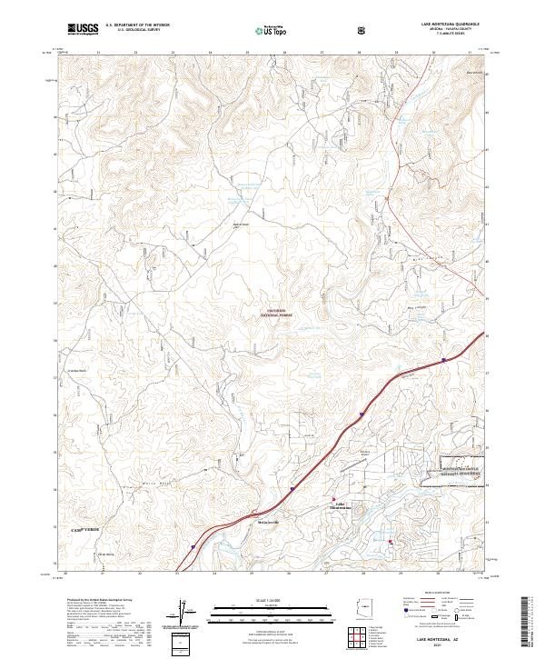
2021 Map of Lake Montezuma
USGS Topo · Published 2021About this map
Lake Montezuma and the surrounding high desert terrain are defined by the convergence of desert washes and perennial waters in this contemporary 2021 survey of Yavapai County. The community of McGuireville sits at the junction of modern transit corridors, while the protected lands of Coconino National Forest and Montezuma Castle National Monument preserve the archaeological and natural heritage of the Verde Valley. The landscape is a network of named springs and tanks, such as Beaverhead Spring and Winter Cabin Tank, which historically supported ranching across the Beaverhead Flat. Local transportation history is marked by the Chaves Trl, cutting through canyons like Bias Canyon and Hog Canyon to the northeast. To the west, the White Hills rise above Camp Verde, overlooking the riparian corridors of Wet Beaver Cr and Dry Beaver Cr.
Find a feature on this map
45 named features on this map. Tap any name to fly to it.
Don’t see what you’re looking for? This feature index may not catch every label — zoom into the map to look around manually.
Map Details
Editions of this 2021 Lake Montezuma Map
This is the sole edition of this map. No revisions or reprints were ever made.
Other maps of this area

1887 · Verde
USGS Topo · 1:250,000

1892 · Verde
USGS Topo · 1:250,000

1923 · Camp Verde
USGS Topo · 1:125,000

1932 · Camp Verde
USGS Topo · 1:125,000

1936 · Camp Verde
USGS Topo · 1:125,000

1954 · Holbrook
USGS Topo · 1:250,000

1957 · Holbrook
USGS Topo · 1:250,000

1958 · Holbrook
USGS Topo · 1:250,000

1960 · Holbrook
USGS Topo · 1:250,000
1965 · Munds Mountain
USGS Topo · 1:24,000